


|
|
|
|
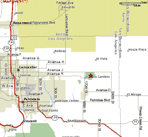
Maps to AVAC Observing SitesDriving Directions To:
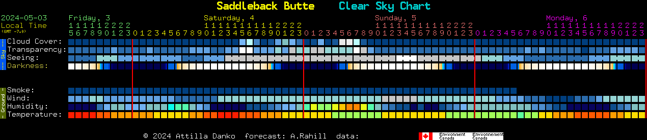
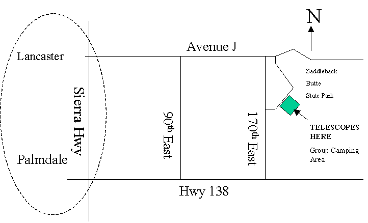
Saddleback Butte State ParkLOCATION: Lat 34.67 N, Long 117.82611 W. ALTITUDE: 2800 ft Saddleback Butte Seeing Conditions
Saddleback Butte Automated Weather Center
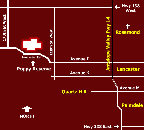
Poppy ReserveLOCATION: ALTITUDE: 3057 ft Antelope Valley Poppy Reserve Mojave Desert State Parks-Ave. I and 165th St. West, Lancaster (661) 942-0662. Take Ave. I west to approximately 165th St. West to the Reserve entrance.
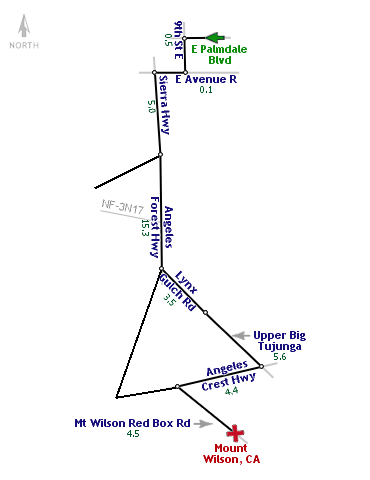
Mt. WilsonLOCATION: Lat 34 13" 27.4' N, Long 118 03" 50.3' W. ALTITUDE: 5680 Feet Weather: http://weather.yahoo.com/forecast/USCA0742.html
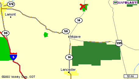
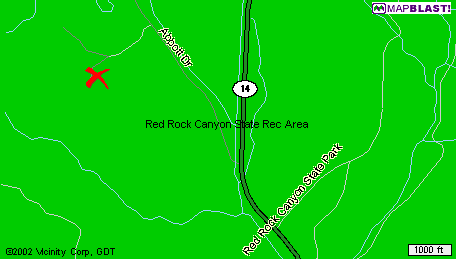
Red Rock Canyon State ParkLOCATION: Lat 35.22.38 N Long -117.59.38 W. ALTITUDE: 2567 ft
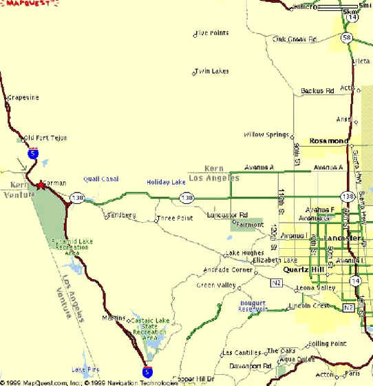
Mt. PinosLOCATION: Lat 34.8332134 N Long -119.167 W. ALTITUDE: 8300 ft
Detailed information about Mt. Pinos can be found here. You will take one and half hours from Palmdale to Mt. Pinos. Take Hwy 14 North to the Hwy 138 off-ramp. Go over Hwy 138 and continue west on Hwy 138 to the I-5 North on-ramp. Continue on I-5 North just past Gorman and take the turn-off on the Frazier Park off-ramp. Turn left underneath I-5 and continue west for 21 miles to Mt. Pinos. (You will pass Frazer Park and follow signs to Mt. Pinos Recreation Area.) After passing through two seasonal snow gates, keep going another 3 1/2 miles. The observing site is a large paved parking area at the very end of the road, at 8300 ft elevation. There is no water there. You must bring you own. We are roughing it. There are portable restrooms. The skies can be fantastic. The temperature can be very cold - even in the Summer! You may camp overnight in the walk in campground only. Check out the information below for the latest sky conditions at Mt. Pinos. MAP TO MT. PINOS
For weather call Frazier Park Forest Service 805-245-3731. For real time weather on the internet visit http://www.frazmtn.com/pmcwebcam
Riverside Telescope Makers Conference And Telescope Expo(RTMC) Location:
Questions? If you have any questions about the Riverside Telescope Makers Conference or would like to request additional registration materials, please call (909) 948-2205, or send e-mail to Robert Stephens at registrar@rtmc-inc.org. Our postal address is: Riverside Telescope Makers Conference and Telescope Expo, Inc. 8300 Utica Avenue, Suite 105 Rancho Cucamonga, CA 91730 (909) 948-2205
Devil's Punchbowl Nature Center
05/25/2015 | |||||||||||||||||||||||||||||||||||||||||||
|