|
|
Mount Pinos Day HikingMt. Pinos is one of my favorite southern Cal deep sky astronomical observing sites, so I'm up there frequently Daytime activities include a number of hikes that range across varying degrees of ability. It's a perfect place for a family day hike or a group of friends that want to push for (a bit more serious) a nice 10 mile day hike. This page has pictures, Suggestions for Day Hikers, overnight backpacker, detailed Hiking Directions/times for a hike that begins at the Mt. Pinos Parking Lot "Nordic Base" and proceeds up to the top of Mt. Pinos and beyond if desired, and finally topographic maps of the area..
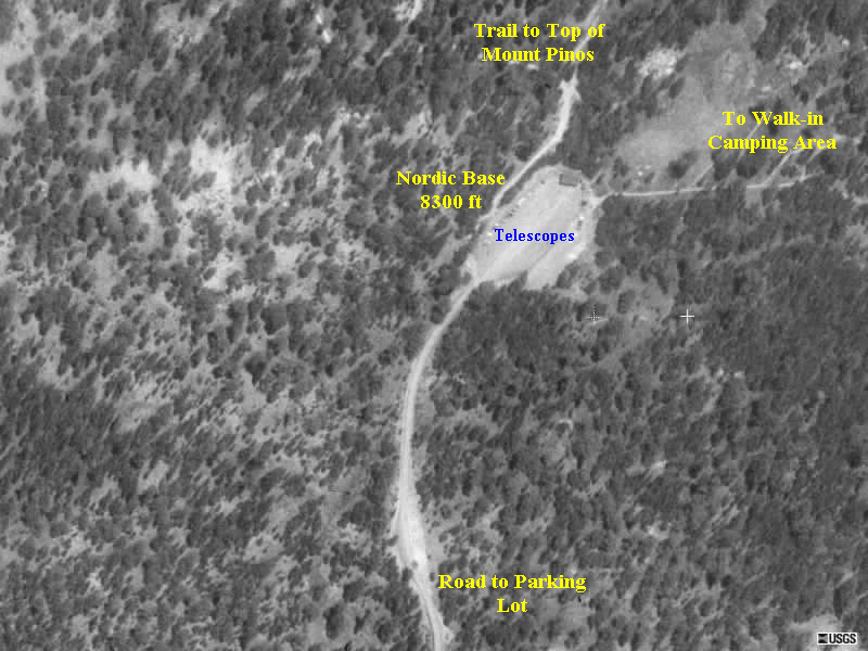
This is a shot of the Mount Pinos parking lot from an aircraft. Annotations by astro-tom.
Recommendations For Day Hikers
********************************************************** Mt. Pinos HikingThe web link has detailed driving directions and maps. Directions: http://astro-tom.com/avac/observing_sites/mount_pinos.htm NOTES: 1. In the winter after a big snowstorm the road above the first snow gate can be closed. In that case, cross-country skiing is more appropriate than hiking. 2. You'll need either a daily ($5) or annual ($35) National Forest Action Pass to park anywhere on the mountain. You can get these at any of the major sporting goods companies including Big 5 and Sports Chalet. 3. Great after-hike pizza at Mike's Pizza next to the road just above Frazier Park. https://www.facebook.com/pages/Mikes-Pizza-Co/173888492693983 4. From the top parking lot that you can see on the satellite photo shown on the web page the "Trail to the Top of Mt. Pinos" begins at a paved parking lot.
The Mt. Pinos - Sheep Camp trail can be divided into two sections:
Below are my "old guy" standard pace times with rest/water breaks for each part of the Mt. Pinos Trail. My times are pretty consistent for 3 season hiking. Mt. Pinos Hike Times Route:
**********************************************************
Times (in Hours:Minutes format) are provided for how long it typically takes me to travel outbound (From the Mt. Pinos parking lot towards Sheep Camp) and for the return (From Sheep Camp towards the Mt. Pinos parking lot.) On the return, my actual departure times for many of the legs are provide to give a sense of how long it will really take to get back, for instance I leave Sheep Camp at 10:10 am and get to the saddle between Sawmill Mountain and Mt. Pinos at 11:25 am. Mt. Pinos parking lot to Mt. Pinos summit: 2.0 mi. (Roundtrip 4 mi) Difficulty: Easy, three 500 ft long sections of moderately steep trail. Hiking Time: 0:43 (outbound) (return) 0:50 (12:00 pm) (I take it easy on the way back down.) Mt. Pinos top to Saddle (small valley between Top of Mt. Pinos and Top of Sawmill Mountain) Difficulty: Easy to Moderate, one 200 ft long moderate section of steep, loose rocky trail. 0:22 (outbound) (return) 0:20. (11:25 am)
Total Times for Saddle to Sawmill Mt Summit Difficulty: Moderate to Hard, steep, rocky trail Total time 1:03 (outbound) Total time (return) 0:20 Details of Saddle to Sawmill Mt Summit: Sub-sections of the portion
Sawmill Mountain summit to Sheep Camp trail sign: Difficulty: Easy, 0:19 (outbound) (return) 0:19 Sheep Camp Sign to Sheep Camp Spring: 0:07 (outbound) (return) 0:11 Arrive Sheep Camp at 9:45 (The two actual overnight camping areas at Sheep camp are 150 ft from the spring at Sheep Camp Campground) 0:25 Lunch, Talk with other hikers Depart Sheep Camp 10:10 am for return trip ********************************************************** Maps of Mt. Pinos, Sawmill Mountain and Sheep Camp for Hike (Right click and save to view full size image)
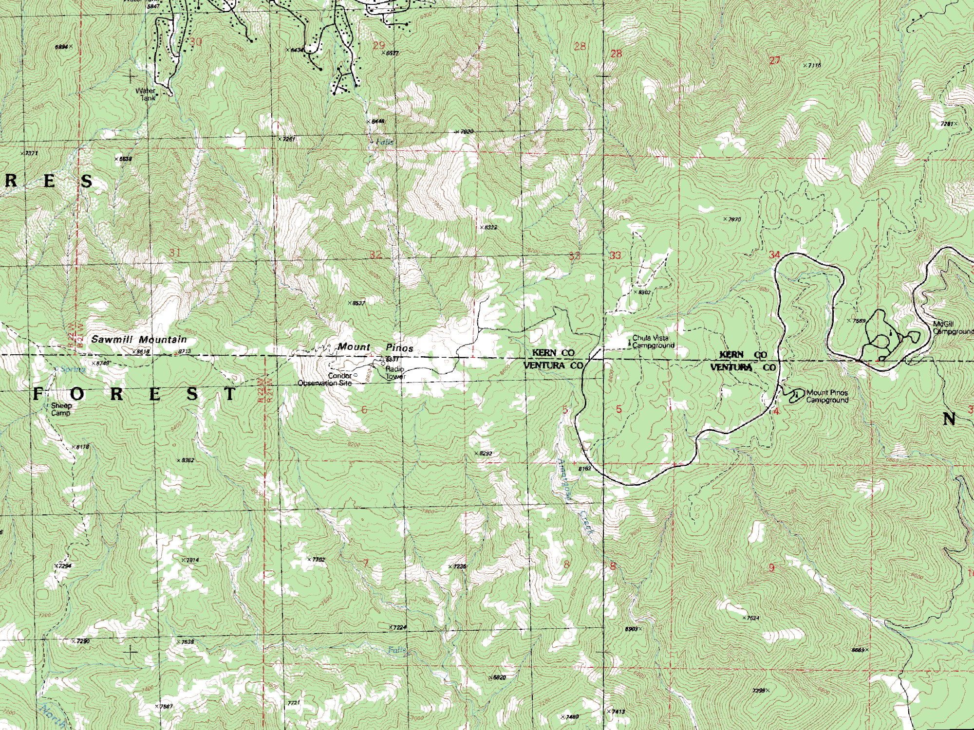
Map 1 - Topographic Map of Mt. Pinos Road, Campgrounds and Hiking Trails
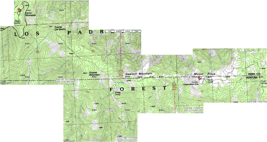
Map 2 - Day Hike Topo Map for Mt. Pinos Area
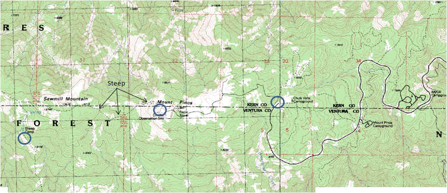
Map 3 - Details - Circles from Right to Left: Mt. Pinos parking lot, Mt. Pinos summit, Sheep Camp and Sheep Camp Spring **********************************************************
02/2015 |
|